Franz Kröger
The original maps (if not noted otherwise) were drawn by Yaw Akumasi Williams
ATLAS OF THE BULSA DISTRICT
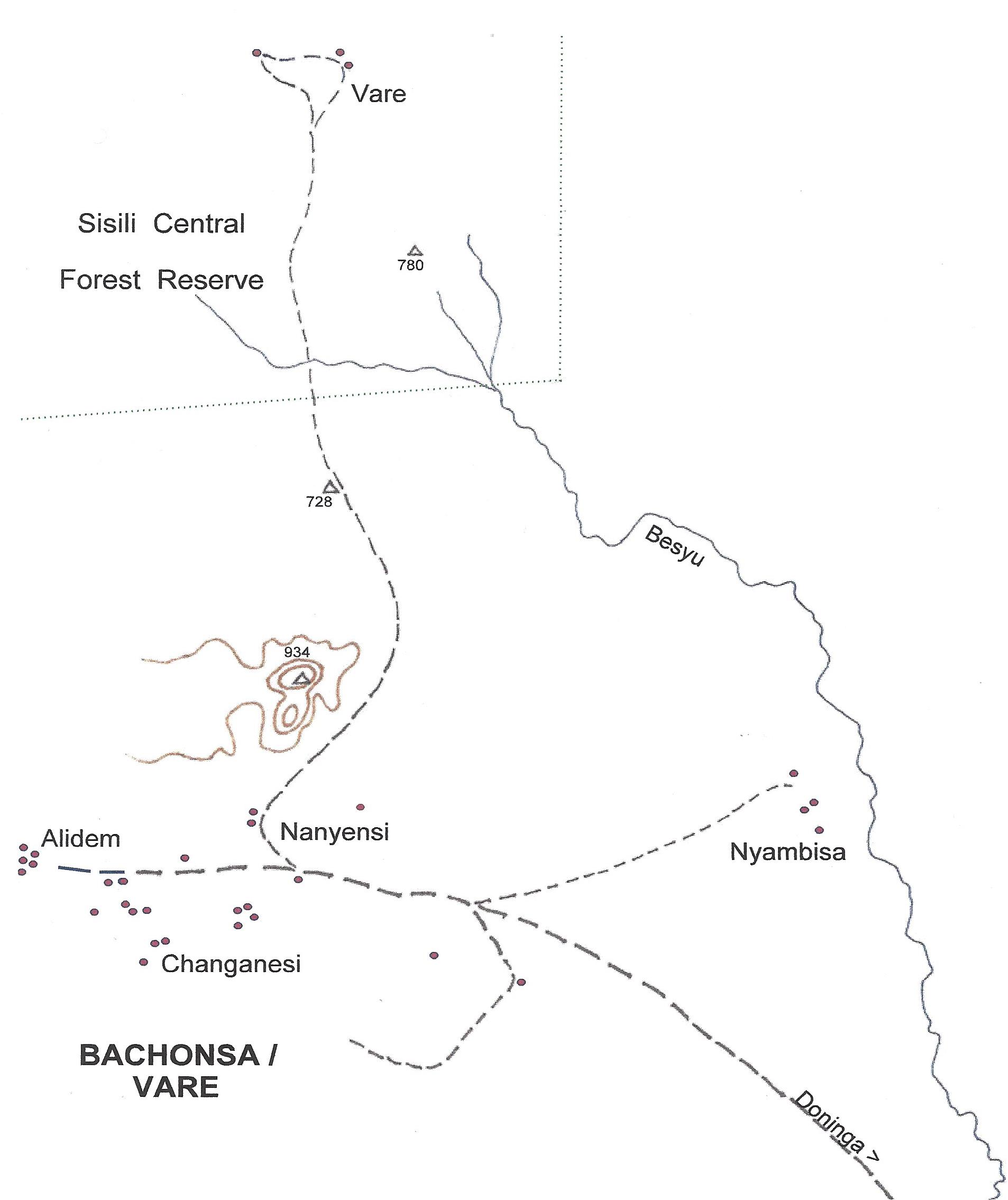
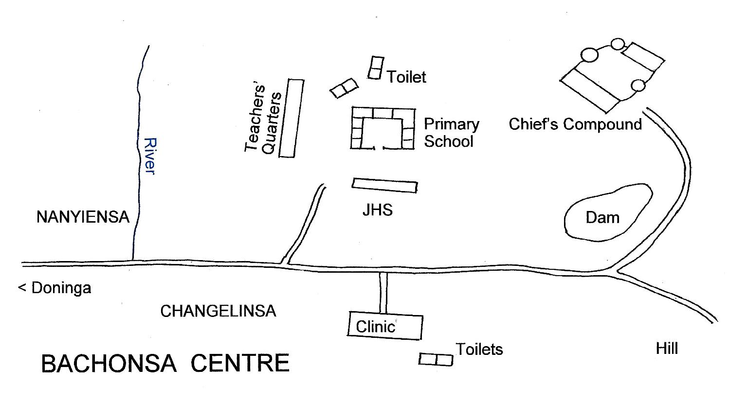
BACHONSA
Although in the past Bachonsa, situated on the old trade route, was apparently of great economic and political importance, it is now the smallest of all Bulsa villages.
|
Locality |
1948 |
1960 |
1970 |
1984 |
2000 |
2010 |
|
Bachonsa /BachuansaAlidem Changelisu Nanyensa Nyanbisi Vare Yimonsa |
378 22 / 2 75 / 6 77 / 6 90 / 7 35 / 4 |
124 / ? 108 / ? 136 / ?
34 / ? |
107/11 89/6 98 / 7 44/5 9 / 3 |
146 /6 |
63 / 5
109 / 5
323 / 12 |
932 / 96 |
Geographical location (Bachonsa centre)
Longitude: 10° 32' 47"; Latitude: 1° 29' 41"
|
|
|
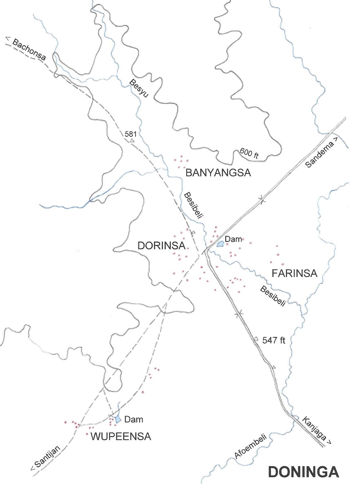
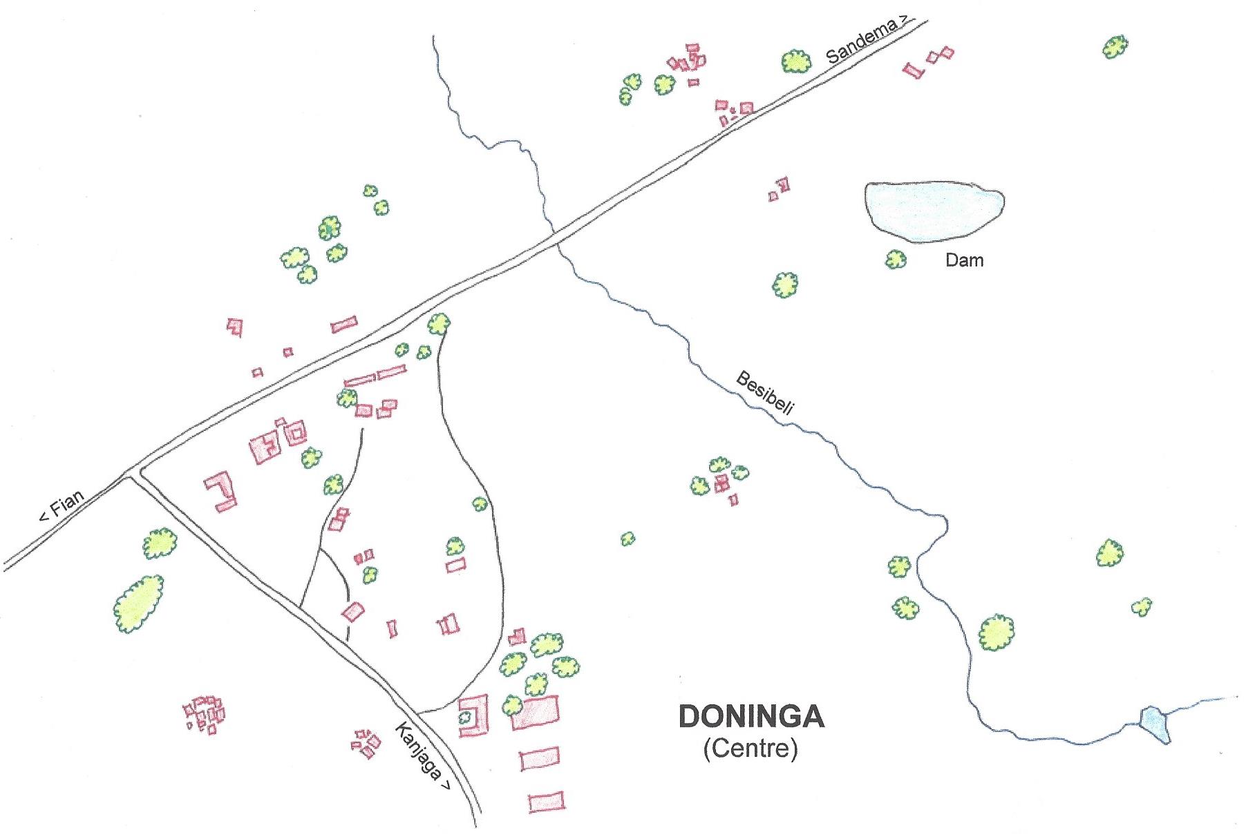
DONINGA
Like Bachonsa, Doninga experienced more splendid periods in its history when it prospered by agriculture and trade.
|
Locality |
1948 |
1960 |
1970 |
1984 |
2000 |
2010 |
|
Doninga Banyansa Dilogsa Dorinsa (Centre) Farinsa Wupeensa W.- Yipaala |
1710 / 21 42 / 3
736 / 56 267 / 24 665 / 38 |
198 / 11
623 / 43 237 / 23 323 / 15 |
234 / 15 233 / 24 329 / 24 135 / 7 |
213 / 12 258 / 16
295 / 24 |
252 / 15
393 / 28 286 / 24 427 / 31 203 / 20 |
Geographical location (Road junction)
Longitude: 10° 36' 57.8"; Latitude: 1° 25' 52"
 |
 |
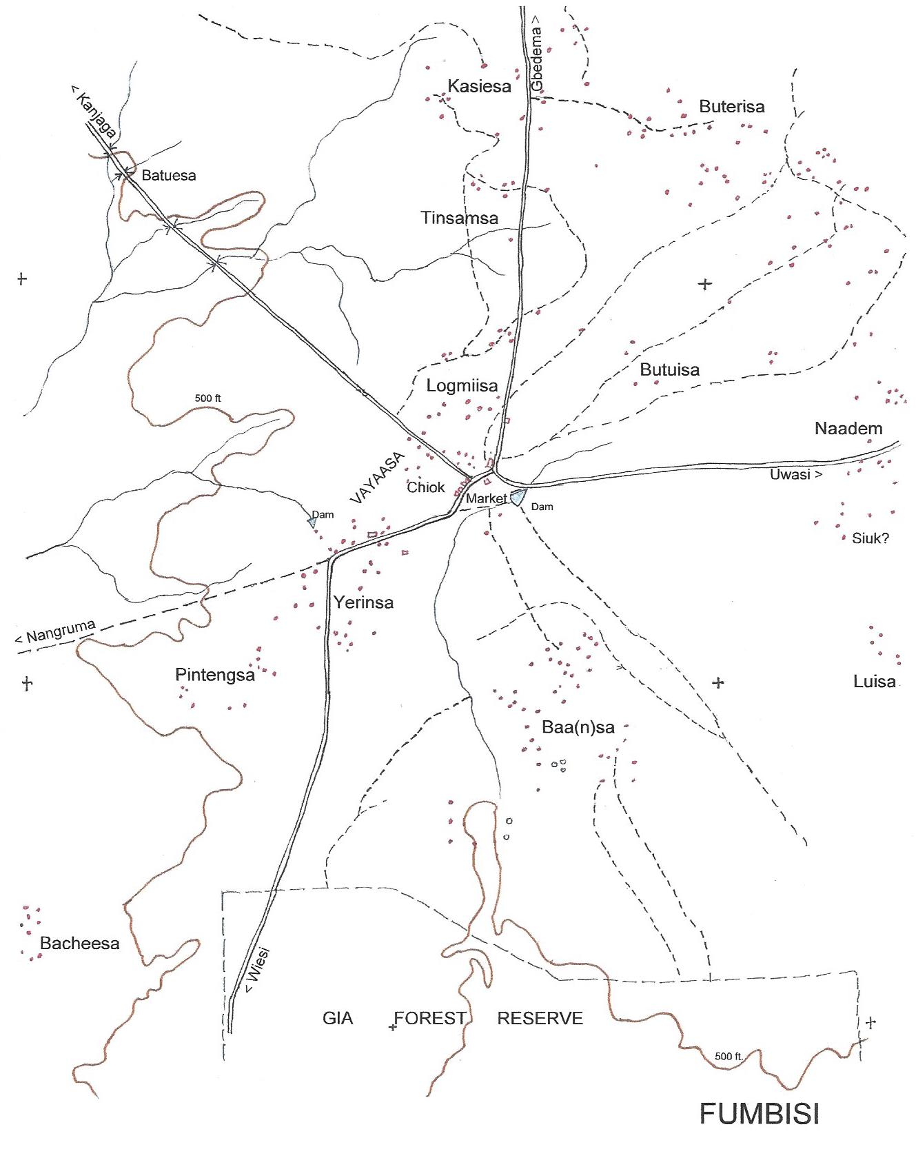
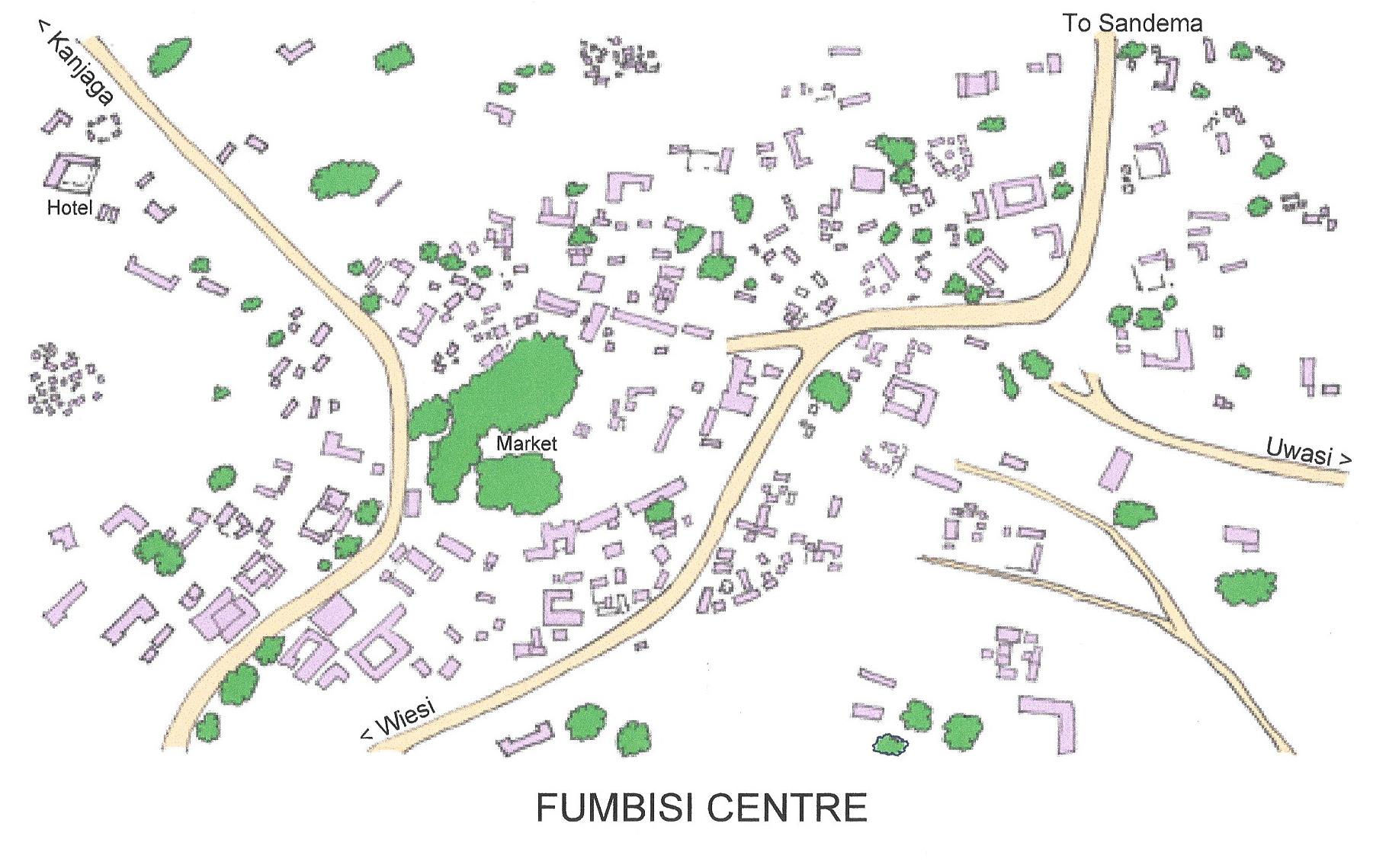
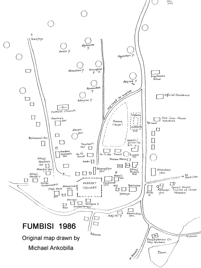
FUMBISI
| 1948
|
1960 | 1970 | 1984 | 2000 | 2010 | |
| Fumbisi | 4494 / 272 |
864 / 278 |
|
|||
| Baasa /Baansa | 723 / 55 | 307 / 61 | 931 / 58 | 438 / 16 | 1131/66 | |
| Changsa | 72 / 2 | |||||
| Chiok | 144 / 9 | 162 / 14 | 122 / 8 | 394 / 22 | 313 / 44 | |
| Kubangsa | 266 / 13 | |||||
| Monsa | 84 / 5 | |||||
| Sunsung | 145 / 11 | |||||
| Bacheesa | 281 / 7 | ? / 14 | 265 / 12 | 181 / 9 | 296 / 15 | |
| Batuisa | 131 / 10 | 173 / 26 | 213 / 12 | 320 / 10 | 346 / 15 | |
| Boterisa / Buterisa | 290 / 10 | 413 / 26 | 455 / 33 | 438 / 25 | 565 / 39 | 1021 /61 |
| Kasiesa | 306 / 20 | ? / 36 | 704 / 36 | 611 / 37 | 765 / 40 | |
| Yemona | 695 / 63 | |||||
| Luisa | ? / 25 | 357 / 25 | 457 / 23 | 420 / 30 | 677 / 56 | |
| Naadem | 1191 / 65 | 704 / 36 | 542 / 33 | 859 / 40 | ||
| Yiesugsung | 822 / 45 | |||||
| Pintengsa | 259 / 15 | 330 / 19 | 332 / 27 | 481 / 32 | ||
| Sinsangsa/Tinangsa | 77 / 9 | 118 / 6 | 117 / 7 | 152 / 9 | 352 / 13 | |
| Siuk | 104 / 9 | 124 / 8 | 104 / 10 | 109 / 7 | 165 / 10 | |
| Vayaasa | ||||||
| Logmi(i)sa | 381 / 25 | ? / 24 | 464 / 26 | 650 / 27 | 522 / 30 | |
| Yerinsa | 607 / 27 | ? / 66 | 1317 / 94 | 1155 / 79 | 421 /22 |
Geographical location (Fumbisi market)
Longitude: 10° 27' 7"; Latitude: 1° 18' 30"
Cf. also: Yaw Akumasi Williams and Franz Kröger: Street Names in Fumbisi (BULUK 10)
|
 |
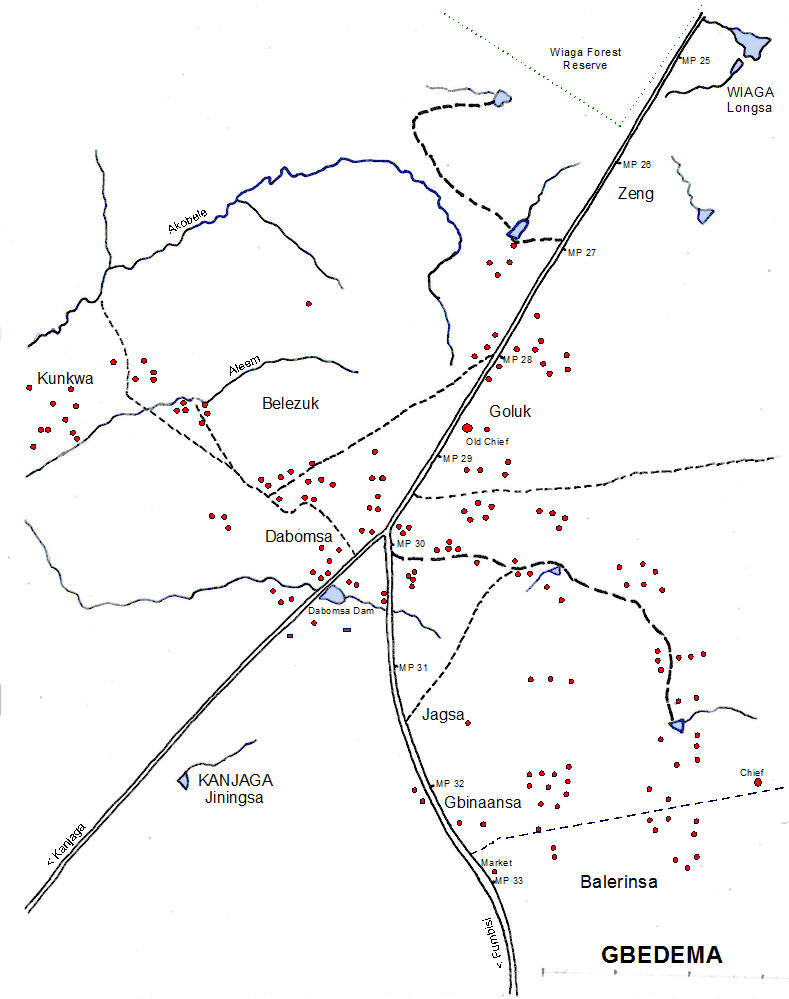
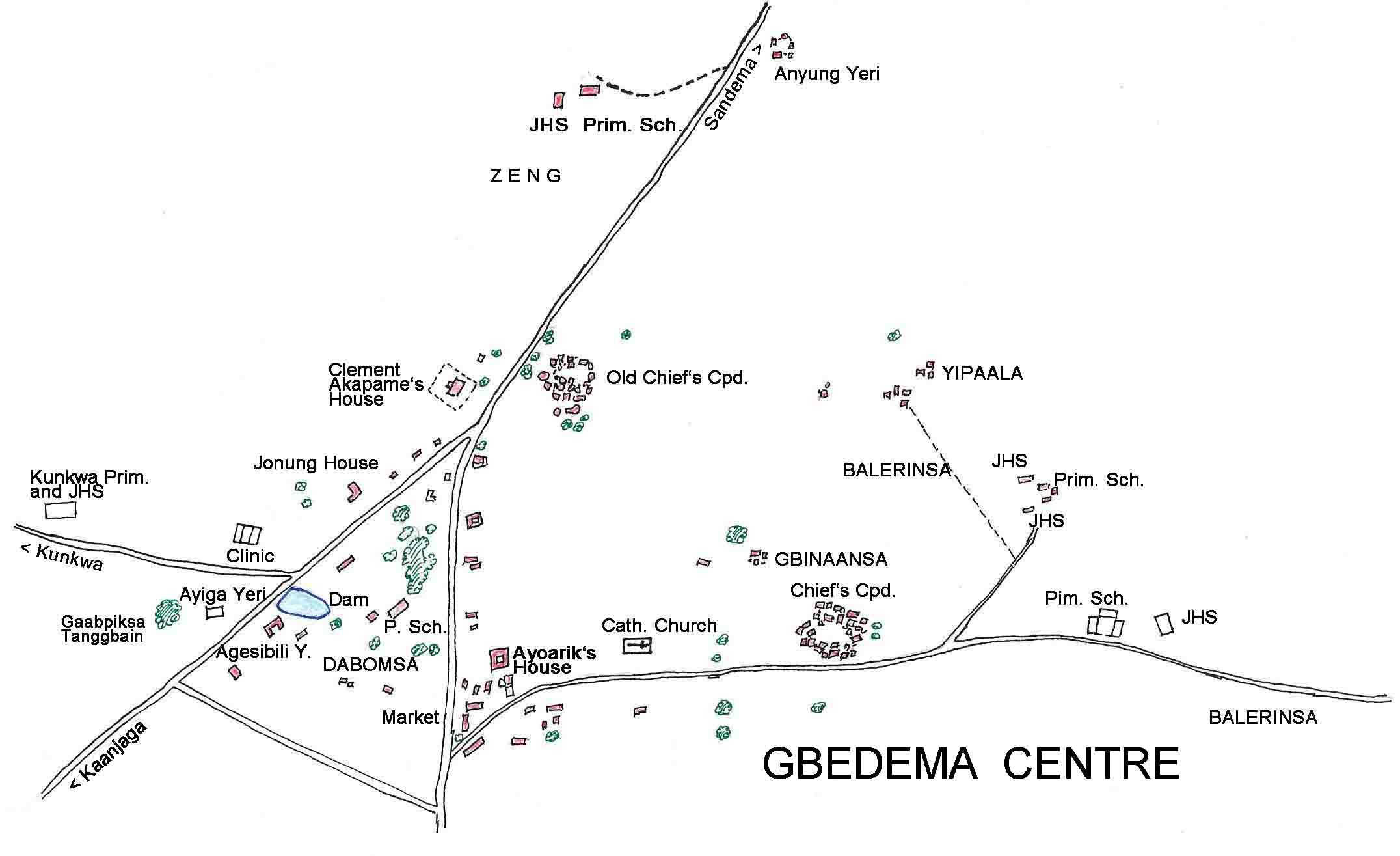
GBEDEMA
|
Locality |
1948 |
1960 |
1970 |
1984 |
2000 |
2010 |
|
Gbedema Dagbomsa Goluk Jagsa Garibiensa Gbinaansa Guuta Kunkwa Zing / Zeng Zongo |
2104 / 131 381 / 20 486 / 31 962 / 64
225 / 16 |
160
199 |
256 / 16 618 / 38 955 / 75
413 / 16 |
|
317 / 19
1049 /64 360 / 17 512 / 30 778 / 38 507 / 41 213 / 56 |
1,222 / 98 745 / 79
760 / 74 (Ku)
|
Geographical location (Junction Kanjaga Road)
Longitude: 10° 34' 24"; Latitude: 1° 19' 18"
 |
 |
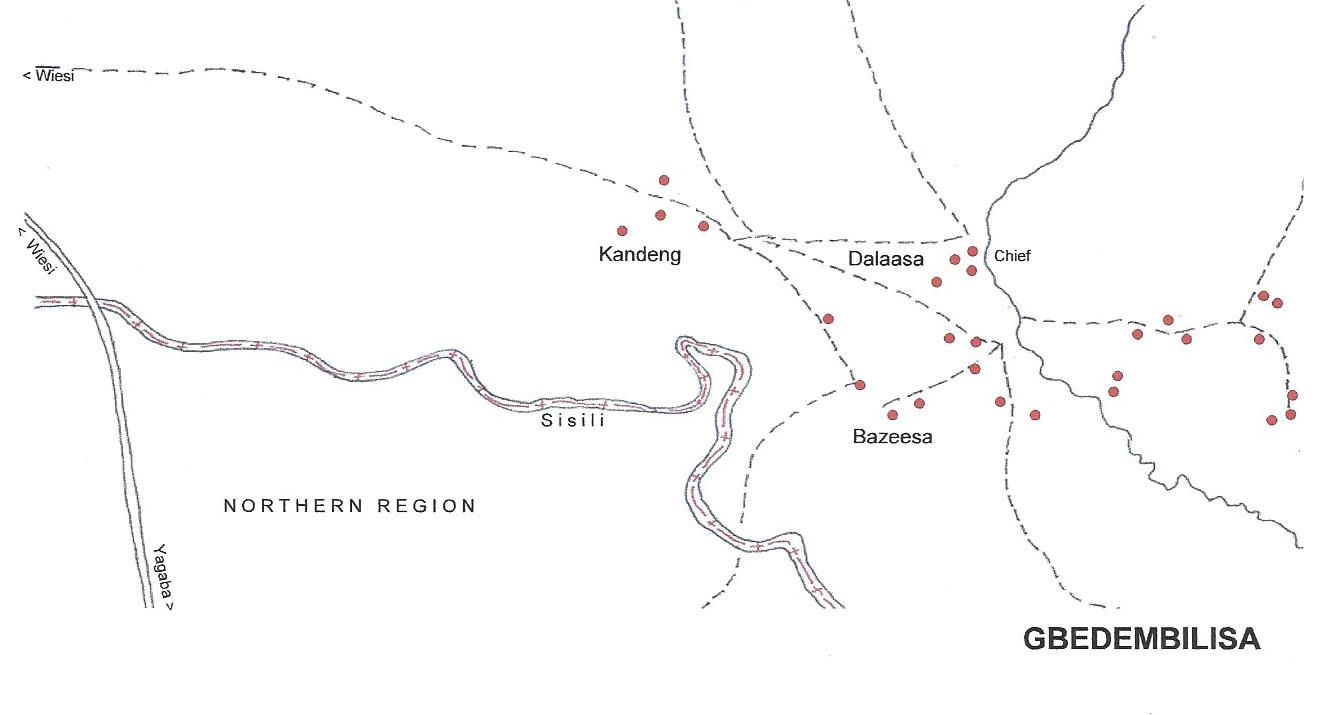
GBEDEMBILISA
|
Locality |
1948 |
1960 |
1970 |
1984 |
2000 |
2010 |
|
Gbedembilisa Bazesa Kadeng Na-Yeri |
87 / 5 |
42 47 |
43 / 4 23 / 4 |
51 / 3 |
38 / 5
285 / 10 |
Geographical location (Chief's compound)
Longitude: 10° 19' 35"; Latitude: 1° 14' 57"
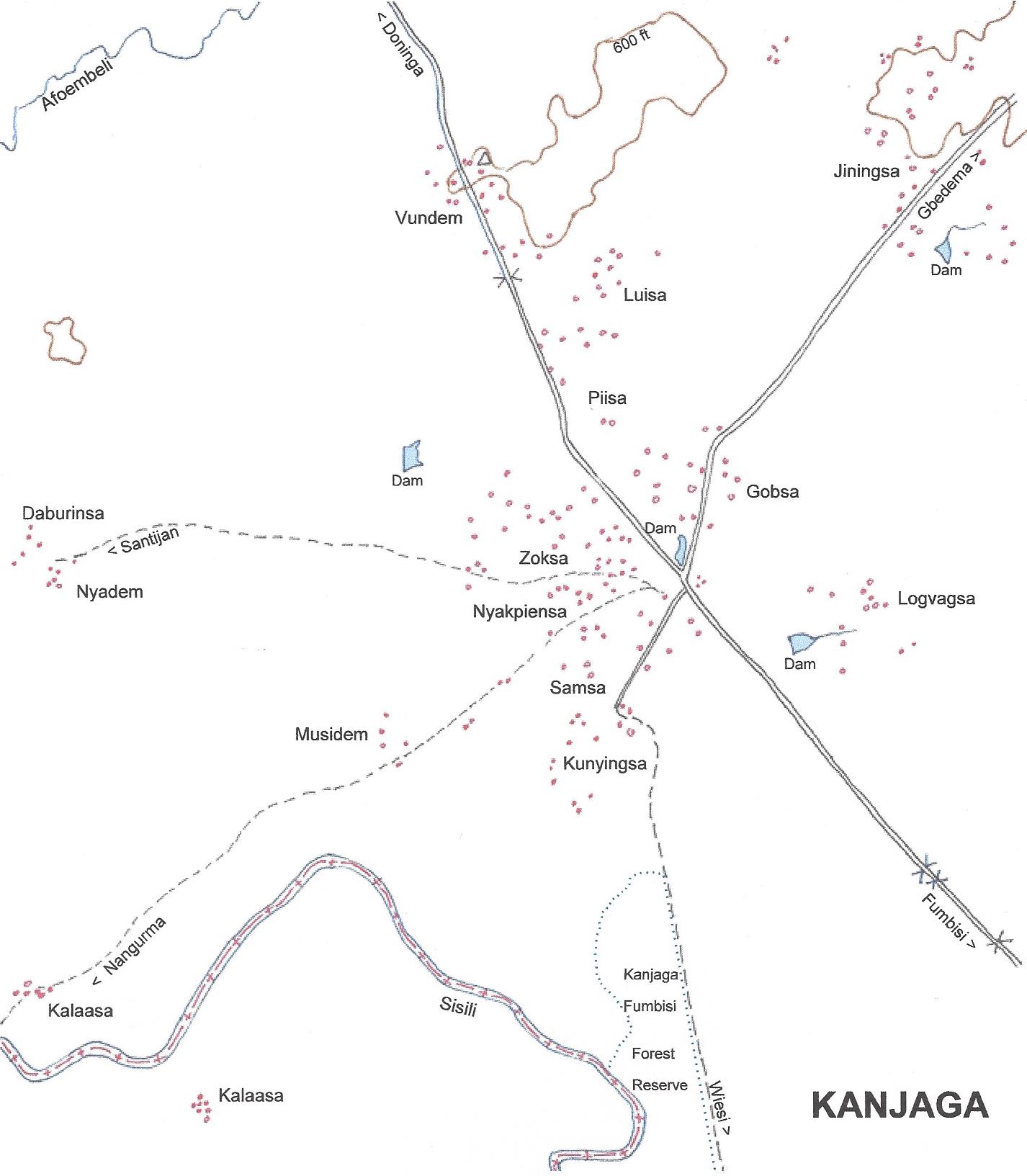
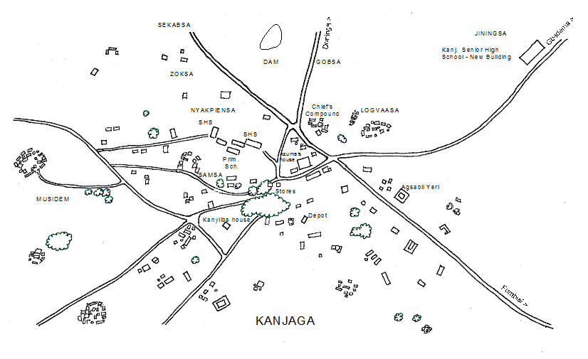
KANJAGA
|
Locality |
1948 |
1960 |
1970 |
1984 |
2000 |
2010 |
|
Kanjaga Daburinsa Gobsa Jiningsa J.-Kori Kalaasa Kunyingsa K.-Yesining Logvagsa Luisa Musidem Nya(n)dem Nyakpeensa (Centre) Piisa Samsa Sikabsa Vundem /Windem Zoksa |
39 / 2 142 / 8 483 / 29
61 / 2 255 / 10
204 / 13 433 / 19 442 / 11 79 / 3 444 / 22 268 / 14 307 / 19 69 / 8 307 / 20 322 / 18 |
77 / 6 154 / 9 564 / 34
87 / 5 440 / 11
263 / 14 598 / 35 330 / 11 117 / 5 575 / 24 309 / 12 555 / 21 86 / 7 229 / 17 257 / 16 |
51 /5 63 / 5 720 / 47
113 / 6 377 / 13
608 / 43 304 / 13 119 / 6 602 / 30 322 / 18 491 / 29 62 / 5 372 / 24 261 / 18 |
661 / 34
341 / 22
55 / 3 802 / 39 322 / 14
466 / 21 522 / 18 631 / 29
460 / 20 212 / 16 |
69 / 4
1110 /84
161 / 10 427 / 39
480 / 28 399 / 35 429 / 49 165 / 12 642 / 54 426 / 25 551 / 43 143 / 10 456 / 35 143 / 12 |
931 / 70
497 / 85 791 /74 795 /110 |
Geographical location (Bachonsa centre)
Longitude: 10° 30' 42.6"; Latitude: 1° 22' 53"
 |
 |
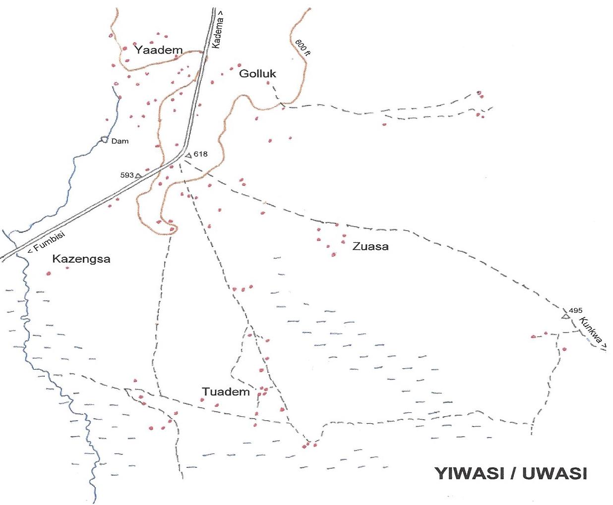
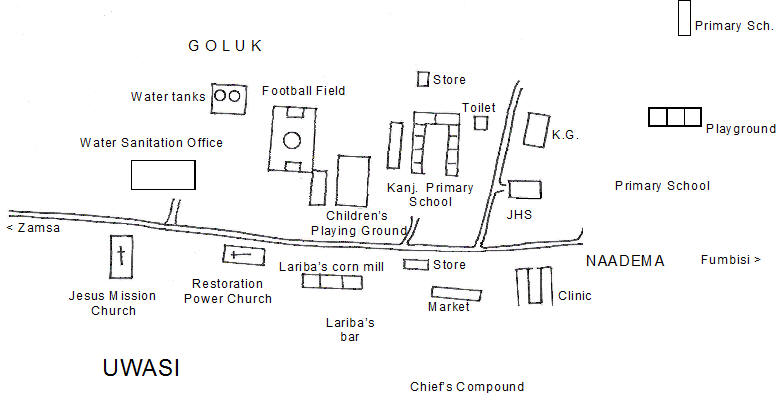
UWASI / YIWASI
|
Locality |
1948 |
1960 |
1970 |
1984 |
2000 |
2010 |
|
Uwasi (Yiwasi) Goluk G.-Chandasi Kazengsa, Centre K.-Jeningsa Tuedem Yadem Zuasa Gangsa Konkon |
1546 / 120 204 / 18
483 / 37
326 / 22 223 / 23 310 / 20 |
283 / 15
458 / 32
344 / 20 241 / 28 313 / 24 |
180 / 13 96 / 9 182 / 21
414 / 23 234 / 30 325 / 19 |
66 / 6 170 / 12 34 / 3 96 / 3 |
495 / 22
443 / 32 576 / 25 498 / 29 514 / 23 |
693 / 60
1031 /80 |
Geographical location (Road bend)
Longitude: 10° 32' 15.2"; Latitude: 1° 13' 48"
 |
 |
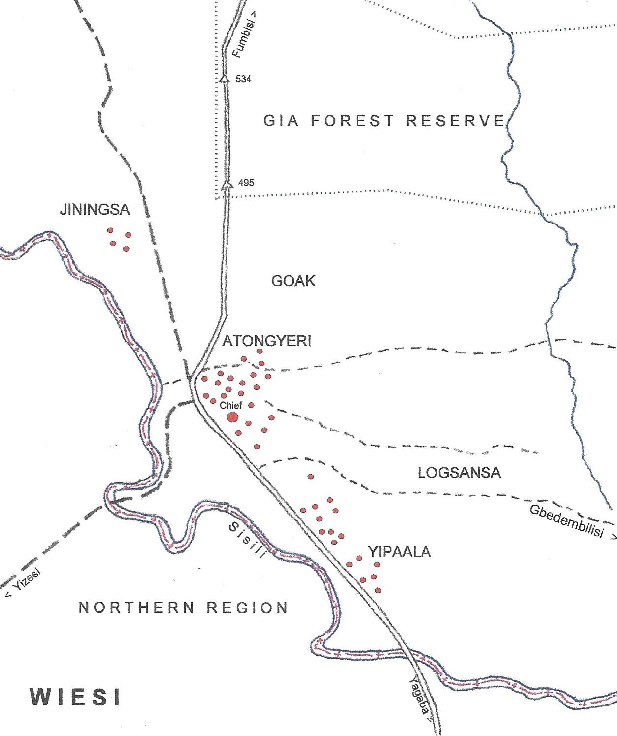
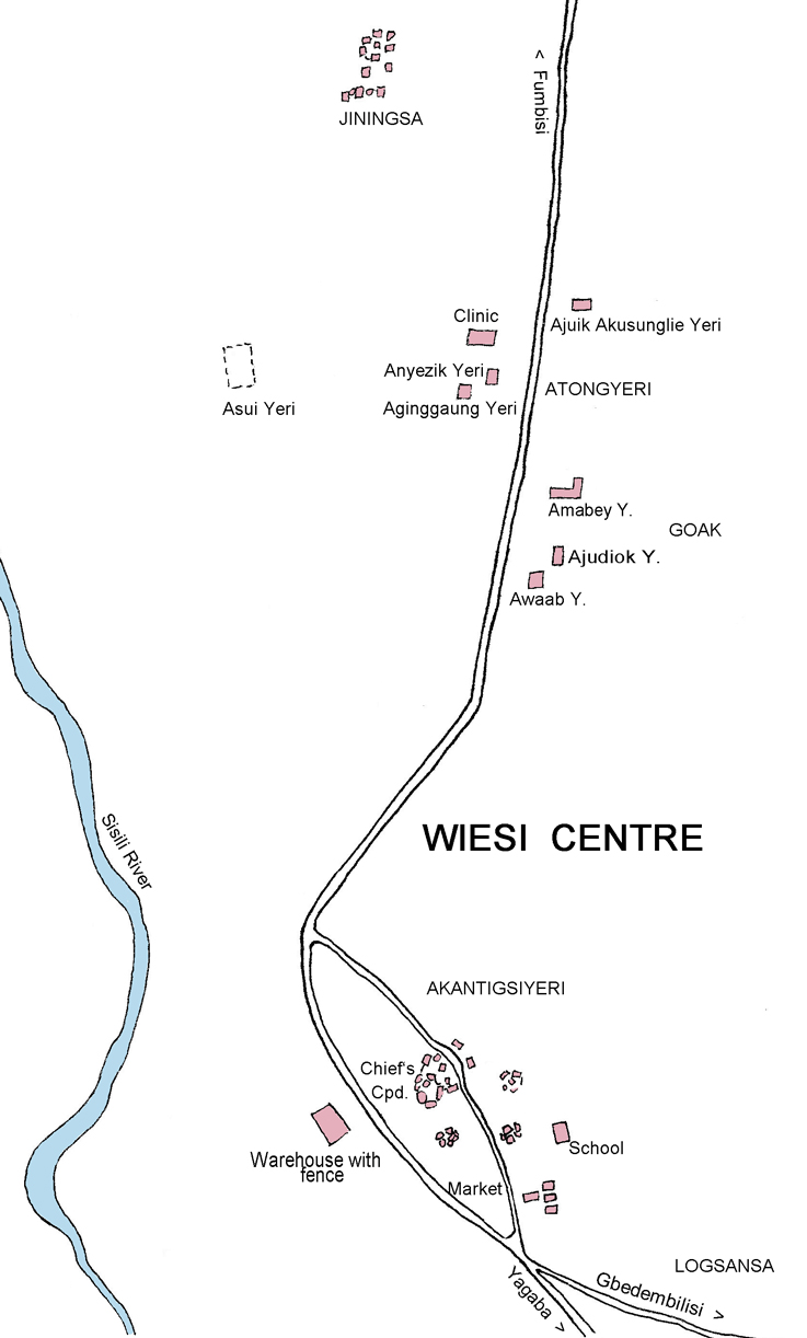
WIESI
|
Locality |
1948 |
1960 |
1970 |
1984 |
2000 |
2010 |
|
Wiesi / Wiasi Atong Yeri, Centre Goak / Gwoo Jinesa / Jinlensa Logzaansa Yipaala |
1881/ 104 700 / 38 317 / 19 276 / 16 231 / 11 270 / 15 |
569 / 23 81 / 7 119 / 8 131 / 8 342 / 18 |
500 / 23 79 / 6 20 / 3 117 / 8 334 / 15 |
625 / 26
73 / 6 |
579 / 36 219 / 23 106 / 13 59 / 5 369 / 18 |
717 / 54 |
Geographical location (Chief's compound)
Longitude: 10° 21' 28"; Latitude: 1° 20' 12"
 |
 |